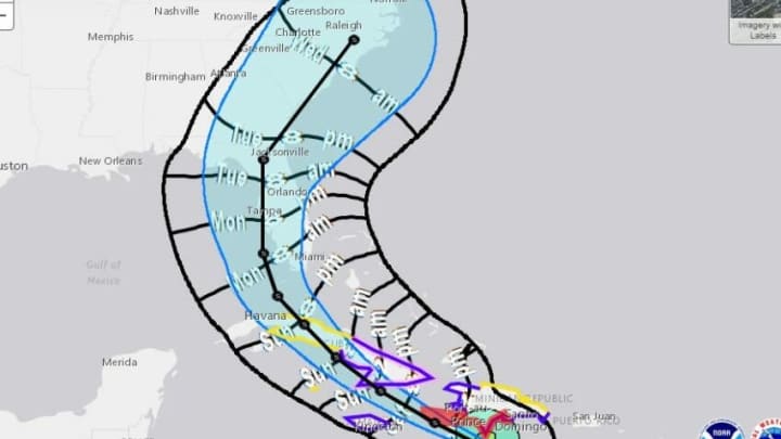
The storm formerly known as Hurricane Elsa is back to being a tropical storm Elsa but the west coast of Florida should be prepared for bad weather.
Elsa only spent about a day or so as a hurricane before quickly returning to a tropical system. It is still packing excessive winds and rain and could cause some damage but the impact of the storm won’t start being felt until Monday.
The current track of the storm takes it into my current abode. I am 45 minutes north of Tampa Bay in Spring Hill and am literally on the water. A clear view in front of where the storm should be coming from. Storm surge could reach as high as three feet according to current predictions.
For those traveling this week, the path is expected to make an eastern turn towards central Florida and could impact the Orlando area and the theme parks by Wednesday. The storm will then push northward into Georgia before impacting the Carolinas as a weakened system.
My view for the week! pic.twitter.com/Gxqk0IVTJe
— PhinPhanatic (@PhinPhanatic) July 4, 2021
Elsa has already caused extensive damage in Dominica’s and is currently moving out of Jamaica and towards Cuba. This land interaction should weaken the storm slightly. If it misses the Cuban island it could gain a little more strength as it turns northward. It is still not expected to regain hurricane strength but that can not be discounted.
Stay tuned with us as I will keep you updated on the current conditions where landfall is expected as much as I can throughout the week. For now, it’s relatively calm seas off the gulf with a light breeze. The calm before the storm. For continued updates visit the National Hurricane Center website or check back here.
